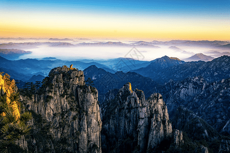
Mount Huangshan, often described as the “loveliest mountain of China,” has played a significant role in the history of Chinese art and literature since the Tang Dynasty around the 8th century. A legend from 747 AD recounts the discovery of the long-sought elixir of immortality on the mountain, which gave Mount Huangshan its name and cemented its place in Chinese history. This legend attracted hermits, poets, and landscape artists, drawn by the dramatic mountainous landscape featuring numerous granite peaks, many over 1,000 meters high, emerging through a perpetual sea of clouds. During the Ming Dynasty in the 16th century, the mountain’s unique rock formations and ancient gnarled trees inspired the influential Shanshui (“Mountain and Water”) school of landscape painting, which profoundly shaped the world’s perception of the oriental landscape.
Located in the humid subtropical monsoon climate zone of Anhui Province, Mount Huangshan covers an area of 16,060 hectares with a buffer zone of 49,000 hectares. It is noted for its botanical richness and the conservation of several locally or nationally endemic plant species, some threatened with extinction.
The cultural significance of Mount Huangshan’s scenic landscape was first recognized during the Tang Dynasty and has been revered ever since. Renamed Huangshan (Yellow Mountain) by imperial order in 747 AD, it became a popular destination for visitors who celebrated its inspiring scenery through painting and poetry, creating a rich body of art and literature of global importance. By the Yuan Dynasty (1271-1368), 64 temples had been constructed on the mountain. In 1606, the monk Pumen established the Fahai Meditation Temple. By the Ming Dynasty, Mount Huangshan had become a favorite theme of Chinese landscape painters, firmly establishing the Shanshui school of landscape painting. The interaction of man and nature in this scenic setting has inspired generations of Chinese artists and writers.
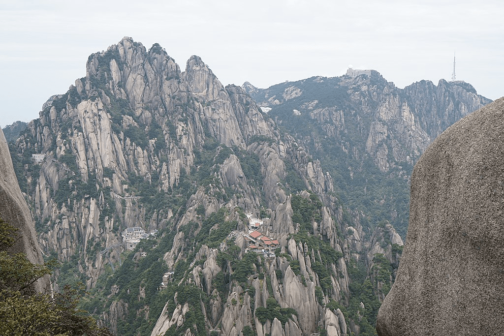
Mount Huangshan is renowned for its magnificent natural scenery, including massive granite boulders and ancient pine trees, often enhanced by cloud and mist effects. The dramatic landscape features natural stone pillars, grotesquely-shaped rocks, waterfalls, caves, lakes, and hot springs, formed by its complex geological history. The mountain range has many peaks, some over 1,000 meters high, with the three tallest and best-known being Lotus Peak (1,864 meters), Bright Peak (1,860 meters), and Celestial Peak (1,829 meters). The World Heritage Site covers a core area of 154 square kilometers and a buffer zone of 142 square kilometers. The mountains were formed in the Mesozoic era, approximately 100 million years ago, when an ancient sea disappeared due to uplift. Later, during the Quaternary Period, glaciers shaped the landscape.

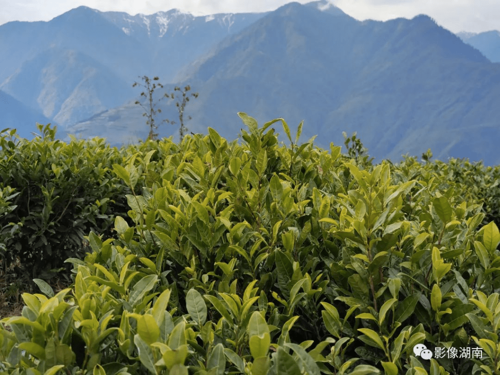
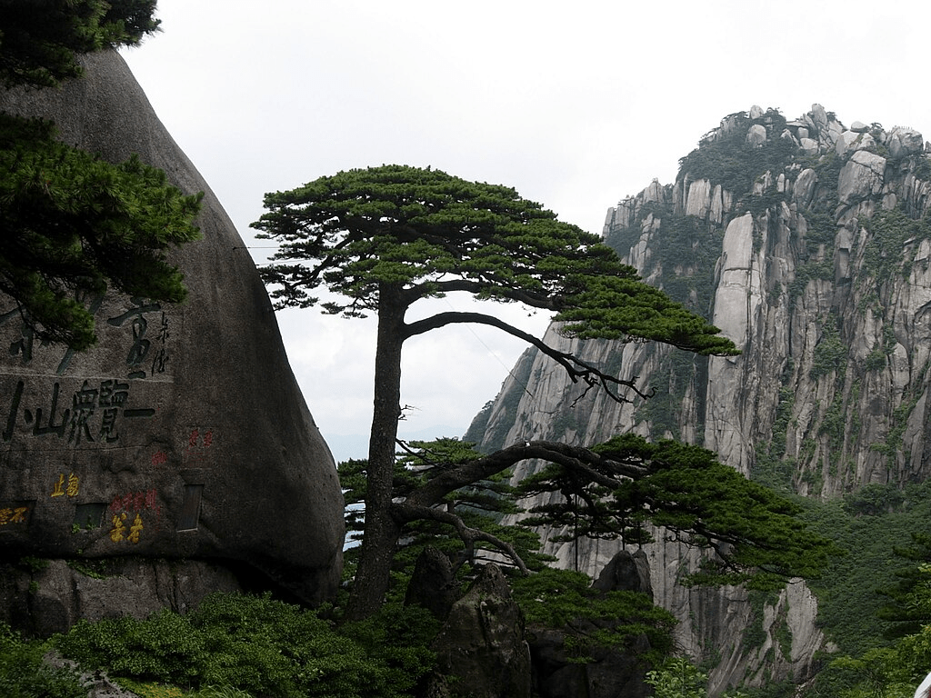
Vegetation varies with elevation, with mesic forests below 1,100 meters, deciduous forests up to the tree line at 1,800 meters, and alpine grasslands above that. The area boasts diverse flora, with one-third of China’s bryophyte families and more than half of its fern families represented. The Huangshan pine (Pinus hwangshanensis), named after the mountain, is a symbol of vigor as it thrives by growing straight out of the rocks. Many pine trees in the area are over a hundred years old and have unique names, such as the Welcoming-Guests Pine, thought to be over 1,500 years old. The pines vary greatly in shape and size, with the most crooked trees considered the most attractive. Huangshan’s moist climate also supports the growth of tea leaves, and the mountain is renowned as one of China’s premier green tea-growing areas. Mao feng cha (“Fur Peak Tea”), a famous local variety, takes its name from the downy tips of tea leaves found in the region.

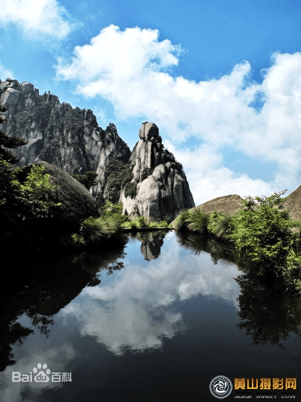
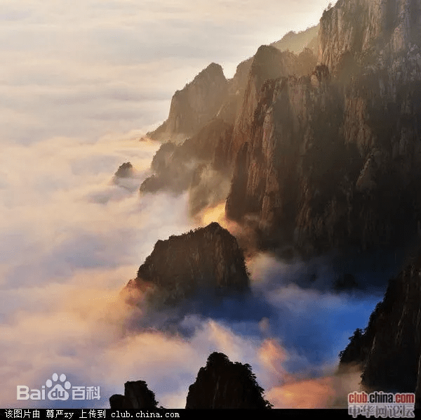
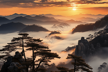
Mount Huangshan often offers views of the clouds from above, known as the Sea of Clouds (yúnhǎi) or “Huangshan Sea,” due to their resemblance to an ocean. Many vistas are named after these cloud formations, such as “North Sea” or “South Sea.” A writer once remarked that to enjoy the magnificence of a mountain, you usually look upwards, but to enjoy Mount Huangshan, you must look downward. The area is also known for notable light effects, such as the renowned sunrises and the phenomenon called Buddha’s Light (fóguāng), which appears only a few times per month.



Mount Huangshan is famous for its stone steps carved into the mountain, with over 60,000 steps throughout the area. The origin date of these steps is unknown, but they are believed to be more than 1,500 years old. Over the years, many scenic spots and physical features have been named, often with narratives behind them. For example, one legend tells of a skeptic who, upon visiting the mountains, was immediately convinced of their beauty. One of the peaks he visited was named Shixin (始信), meaning “start to believe.”


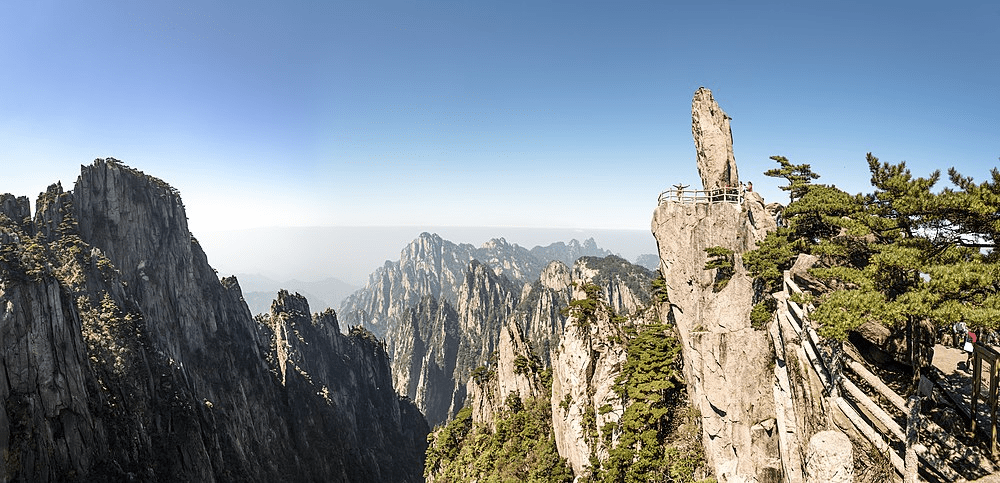

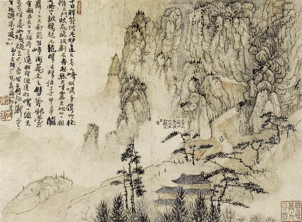
Much of Huangshan’s reputation stems from its significance in Chinese arts and literature. It has inspired poets such as Li Bai, and has been a frequent subject of poetry, Chinese ink painting, and, more recently, photography. From the Tang Dynasty to the end of the Qing Dynasty, over 20,000 poems were written about Huangshan, and a school of painting was named after it. The mountains have also appeared in modern works; director James Cameron cited Huangshan as one of his influences in designing the fictional world of his 2009 film Avatar, and the Chinese animated series Stitch & Ai, a spin-off of Disney’s Lilo & Stitch franchise, is set in the Huangshan mountains.
In 1982, Mount Huangshan was declared a “site of scenic beauty and historic interest” by the State Council of China. It was designated a UNESCO World Heritage Site in 1990 for its scenery and as a habitat for rare and threatened species. Later, it was certified as a National Geopark and subsequently as a regional geopark (Asia Pacific Geopark Network), before being admitted as a UNESCO Global Geopark in 2004.
Mount Huangshan is a habitat for several locally or nationally endemic plant species, many of which are globally threatened. Its flora includes one-third of China’s bryophytes and over half of its pteridophytes. Endemic species to Huangshan include 13 species of pteridophytes and 6 species of higher plants, with many other species endemic to the region or China. This rich flora is complemented by a diverse vertebrate fauna of over 300 species, including 48 mammals, 170 birds, 38 reptiles, 20 amphibians, and 24 fish. Thirteen species are under state protection, including the Clouded Leopard (Neofelis nebulosa, VU) and the Oriental Stork (Ciconia boyciana, EN).


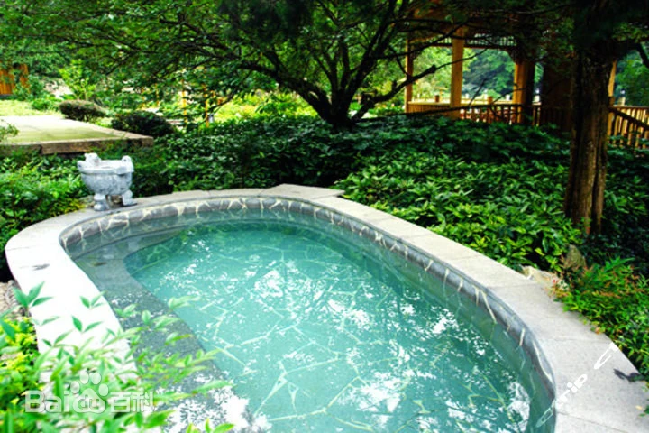
Additionally, Mount Huangshan has multiple hot springs, mainly located at the foot of Purple Cloud Peak. The water, maintaining a temperature of 42°C (107.6°F) year-round, is rich in carbonates and is said to help prevent skin, joint, and nerve illnesses.


The area has also been a site for scientific research due to its diverse flora and wildlife. In the early 20th century, both Chinese and foreign scientists studied the geology and vegetation of Huangshan. Research continues, such as a late 20th-century field study of Tibetan macaques, a local monkey species.


Link:https://peacelilysite.com/2024/05/30/mount-huangshan/
Source: https://whc.unesco.org/en/list/547/, https://en.wikipedia.org/wiki/Huangshan,https://baike.baidu.com/item/%E9%BB%84%E5%B1%B1%E9%A3%8E%E6%99%AF%E5%8C%BA/1350521